


59 Zones, Rising Waters, 18 Dead: The Flood Crisis Tearing Through Tana River and Beyond


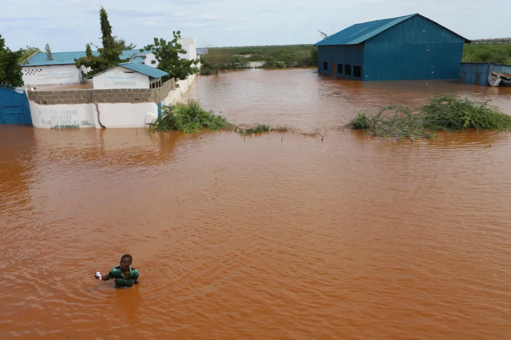
TANA RIVER COUNTY — The Kenyan government has mapped 59 flood-prone zones across Tana River County as swelling waters from the Seven Forks Dam push the lower stretches of the Tana River to dangerous levels part of a widening national flood disaster that has already claimed at least 18 lives.
The mapping exercise, conducted by the Ministry of Interior, identifies the communities most at risk as heavy rains continue to batter large parts of the country. Authorities are urging residents in vulnerable areas to remain on high alert and relocate to higher ground when directed.
Where the Risk Is Highest
Of the 59 high-risk zones identified in Tana River County, the bulk are concentrated in Tana Delta Sub-County, which accounts for 32 of the flagged areas. The remaining zones are spread across:
- Tana River Sub-County — 10 areas
- Bangale Sub-County — 8 areas
- Tarasaa Sub-County — 6 areas
- Tana North Sub-County — 3 areas


Low-lying settlements within Tana Delta including Feji, Kiembe, Halubha, Kipini, and Ozi Mtangani — have been singled out as especially vulnerable due to their geography and proximity to the river’s flood plain. Similar dangers persist in parts of Bangale, Tana North, and Tarasaa sub-counties.
A National Crisis Unfolding
The situation in Tana River is a microcosm of a much wider emergency gripping Kenya. As of 2nd May 2026, flooding across the country has killed at least 18 people, the majority in drowning incidents.
The breakdown of fatalities by region tells a grim picture:
- Eastern Region — 9 deaths (highest nationally)
- Central Region — 3 deaths
- Coast Region — 2 deaths
- Nairobi — 2 deaths
- Rift Valley — 2 deaths
In Nairobi, approximately 6,600 residents have been directly affected by flooding, with roads, schools, and homes damaged across multiple sub-counties.
In the Central region, Kirinyaga and Kiambu counties have recorded widespread destruction. In Mwea West alone, around 3,000 people have been displaced from their homes.
Makueni County in the Eastern region has recorded the highest number of flood-related deaths, with flash floods and mudslides tearing through homes and cutting off transport and power infrastructure.
Government Response

Multi-agency response teams are on the ground monitoring the evolving situation and coordinating emergency interventions across affected regions. Officials have stressed that preparedness and timely evacuation are the most effective tools against further loss of life.
Residents along the Lower Tana River and all other flood-prone areas nationwide have been advised to stay alert, monitor official communications, and act swiftly on evacuation directives.


